

 Categories
  Areas
Areas  Place a FREE ad
 Colors


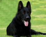
 Free/Lost/Found/Stolen/Missing German Shepherds Dogs


![]() German Shepherd Dog Owner, Trainer and Breeder Gifts
German Shepherd Dog Owner, Trainer and Breeder Gifts
![]() German Shepherd Gifts for Owners, Trainers and Breeders
German Shepherd Gifts for Owners, Trainers and Breeders
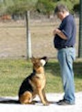 German Shepherd Obedience Trainers
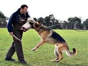
 German Shepherd Protection Dogs


 German Shepherd Schutzhund/IPO Clubs and Organizations
 German Shepherd Schutzhund/IPO Protection Dog Trainers

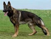
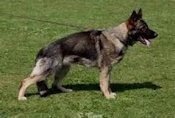
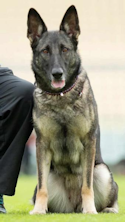 German Shepherd Working Line Dogs


Garmin Astro 320 GPS Tracker for Sporting Dogs (Unit Only, US)
| 2436 | ||||
| Able to track up to 10 dogs simultaneously. Edition: 320 & Collar Bundle | ||||
| Tags: | ||||
| Ad type: Offer | ||||
Click the Image Directly ^^^Above^^^ for More Information, Current Pricing and Availability.
Product DescriptionGSDsite.com Edition: 320 Unit Only Premier Tracking System for Sporting Dogs
 The unique Astro 320 dog tracking system pinpoints your dog's position and shows you exactly where he is on a vivid color screen, even when you can’t see or hear him. The Astro system has the features you've been asking for, such as increased range and battery life, more durable antenna, a simplified user interface and must-have mapping capability. See Your Dogs’ Every MoveThe Astro system includes the Astro 320 handheld and the rugged DC™ 50 transmitter collar¹ with an orange polyurethane strap (accessory color straps sold separately). DC 50 features top mounted GPS and GLONASS receivers and a newly-redesigned steel VHF antenna. Switching to rescue mode reduces the refresh rate in order to preserve battery life, giving you more time to look for a lost dog. Plus, Collar Lock creates a 4-digit PIN number that helps prevent others from seeing your dog’s whereabouts — a useful feature in field trials to ensure that an Astro is used only as a recovery tool when a dog in competition becomes lost. Bark Detection lets you know your dog is barking even if it’s out of audible range, a crucial feature for treeing hounds or running hounds that cover a lot of ground, even in heavy cover. Improvements to the AstroThe intuitive and easy-to-use Astro system takes dog tracking to an entirely new level with new software for the 320 which supports the DC 50 dog device and adds new features, such as bark detection. The interface streamlines what is displayed by allowing dogs that are outside the current zoom level to have their location notated in the display’s margin. You can also choose the amount of each dog’s tracklog displayed, or toggle it off completely, to avoid cluttering the map. The Astro 320, compatible with any DC-series transmitter, also has enhanced map drawing capabilities, BirdsEye Satellite Imagery compatibility (subscription required), vibration-based alerts and a 3-axis electronic compass. Both durable and waterproof, the Astro 320 system features the legendary toughness that’s built to withstand the elements, whether it’s dust, dirt, humidity or water. Nothing is a match for this essential hunting companion. Upgrade with EaseGetting what you need for the hunt is now a little easier. You can purchase the entire Astro bundle or as many DC 50 collars as you need. And your 320 is compatible with every DC series dog collar. The DC 50 is our only dog device with remote bark detection and improved battery life (including battery preserving rescue mode). The improved battery life means when you set your update rate to every 5 seconds the battery lasts 26 hours. In rescue mode, the battery lasts 54 hours, giving you more time to find your lost dog. Additional MappingAstro 320 has a microSD™ card slot so you can load TOPO U.S. 24K maps for land elevation contours or City Navigator NT® map data for turn-by-turn routing on roads. Astro 320 also supports BirdsEye Satellite Imagery (subscription required), that so you can download satellite images to your device and integrate them with your maps. Mapping depicts important nearby geographical features and lets you know if your dog has crossed a creek or is nearing a dangerous road. Astro 320 is also compatible with Garmin Custom Maps, free software that transforms paper and electronic maps into downloadable maps for your device. Track Dogs in Dense CoverAs often as every 5 seconds, your dog’s DC 50 transmits his position to your handheld, and you can see his current location and a trail of where he’s been on the map page of your handheld. Switch over to the Dog Tracker page to view a compass pointing to your dog’s location as well as his current status: whether he’s running, sitting, on point or treeing quarry. Astro also can let you know when your dog is barking, even if he’s out of audible range. You can also see each dog’s precise distance on the map page, and you can choose to auto zoom the map so all dogs can be seen on the display at any time. Dogs that are too far away to fit on the map’s current zoom scale can be notated on the display’s margin in the direction of the dog’s location. You can also choose the duration that each dog’s tracklog is viewed on the display, or toggle it off completely. Astro boasts a high-sensitivity GPS and GLONASS receiver which is mounted to the top of the collar so that can track your dog’s position even in heavy tree cover or deep canyons. You can track up to 10 dogs at one time with Astro, from up to 9 miles away (depending on terrain). The system transmits information by line-of-sight, so it reaches farthest in flat, open territory. Count Your CoveysAfter you’ve captured your quarry, mark the exact spot with Astro’s Covey Counter™, a special waypoint that tells you the exact location, time of day and elevation where you found your prey, as well as the number of birds you flushed and took from that location. Astro lets you save other special waypoints, such as “Truck” and “Lodge,” so you can save the location of these places quickly and easily for each hunt. Astro also offers special waypoint icons to represent food plots, tree stands and other hunting-related points. Plan Your Next TripTake charge of your next adventure with BaseCamp, software that lets you view and organize maps, waypoints, routes, and tracks. This free trip-planning software even allows you to create Garmin Adventures that you can share with friends, family or fellow explorers. BaseCamp displays topographic map data in 2-D or 3-D on your computer screen, including contour lines and elevation profiles. It also can transfer an unlimited amount of satellite images to your device when paired with a BirdsEye Satellite Imagery subscription. Turn Your Computer Into a Base Station for Tracking DogsThe all-new BaseStation lets you turn your laptop (loaded with BaseCamp) into a field control center for tracking multiple dogs (additional DC 50 collar units required). View real-time GPS/GLONASS information on the larger display of your computer, making it ideal for canine search and rescue teams. And because it’s Garmin GPS-based, safer, more effective tracking is possible, even where Internet and cell phone service isn’t. | ||||
 PDF PDF |
||||
Bookmark and share this classified:
| ||||
| All content of this listing belongs to the Owner in this Listing! Copyright © All Rights Reserved. | ||||

 Rating: 0.00 (0 votes)
Enter comment